
Loading…
Loading…
(You are in the browser Reader mode)
Bible Maps
The following maps are in the public domain. They were published in 1888 by the American Bible Society. KJRSBM 1.1
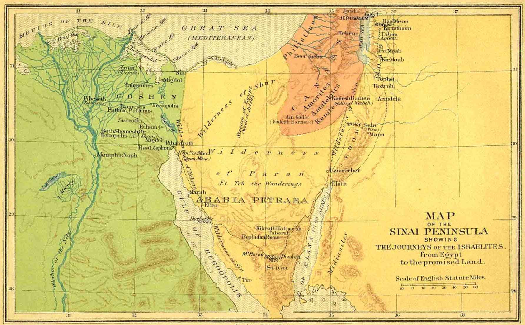
Picture: Map of the Sinai Peninsula Showing the Journeys of the Israelites from Egypt to the Promised Land. KJRSBM 1.2
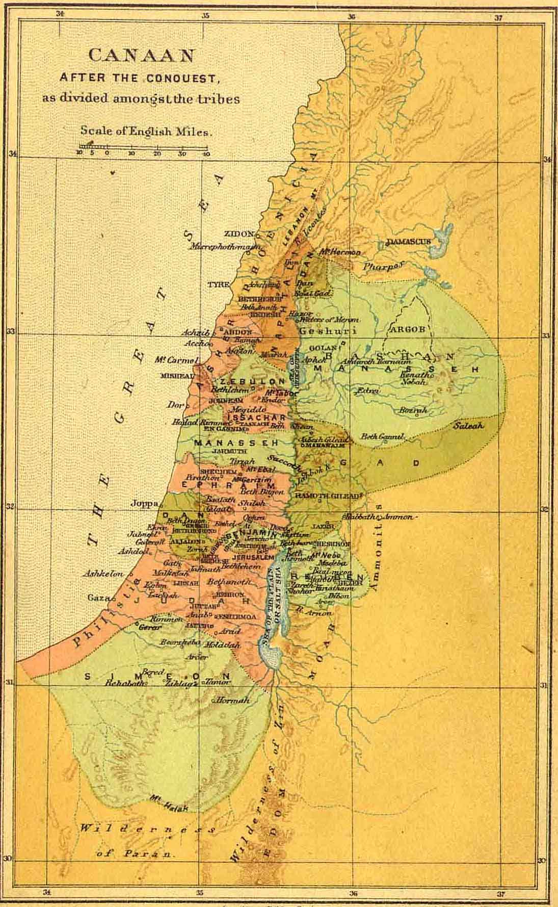
Picture: Canaan After the Conquest as Divided Amongst the Tribes. KJRSBM 1.3
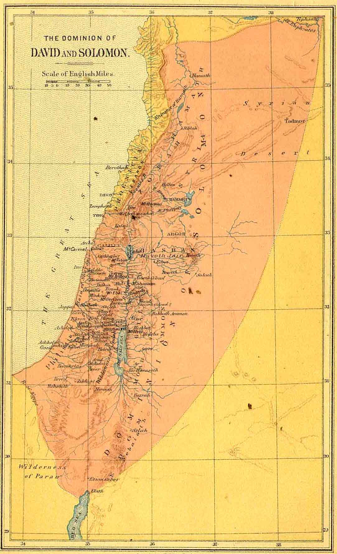
Picture: The Dominion of David and Solomon. KJRSBM 1.4
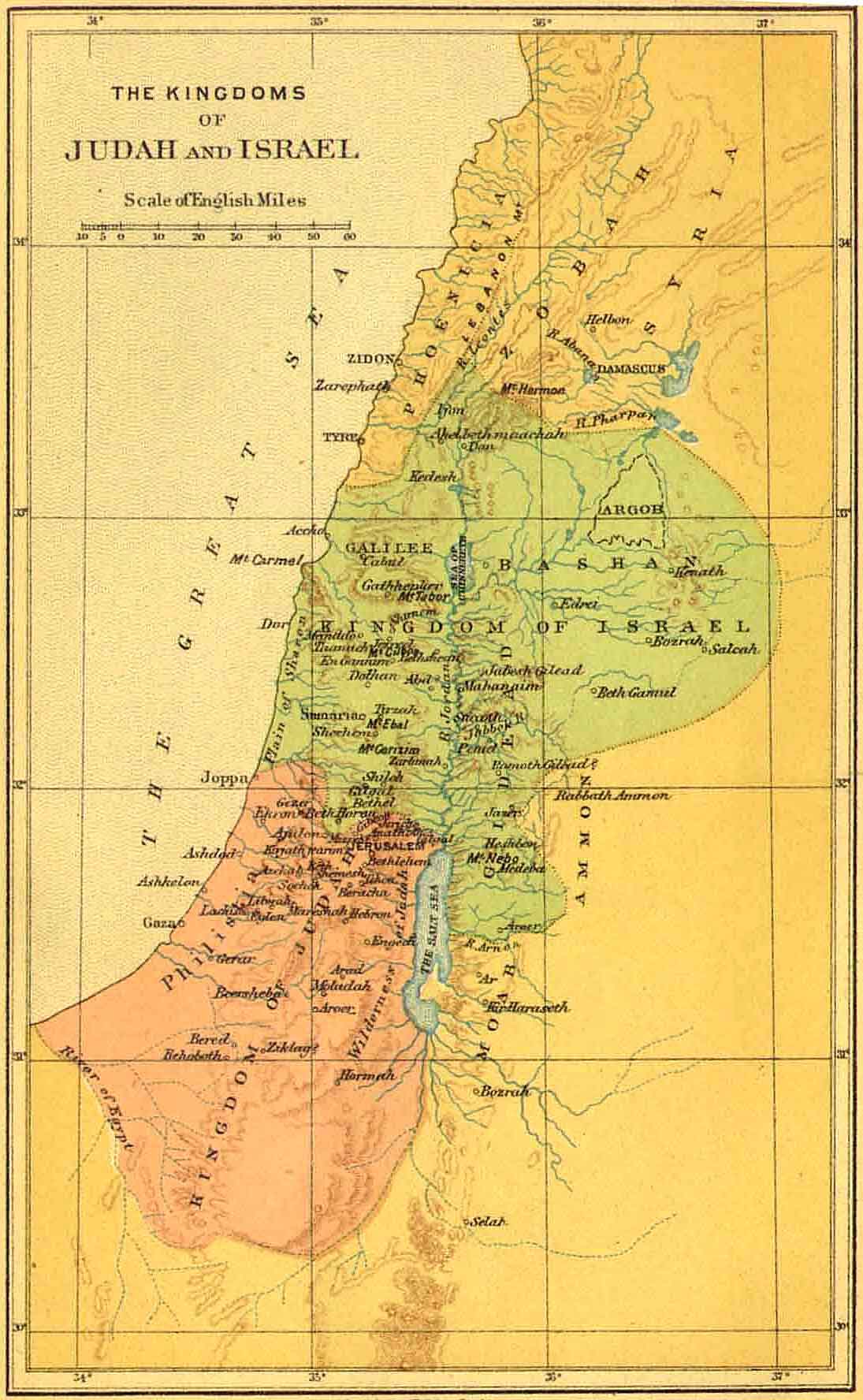
Picture: The Kingdoms of Judah and Israel. KJRSBM 1.5
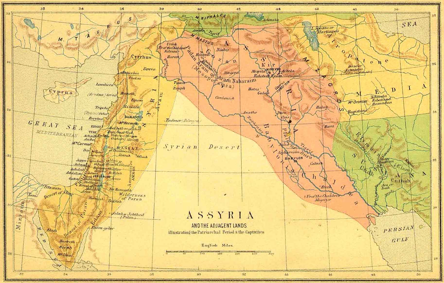
Picture: Assyria and the Adjacent Lands Illustrating the Patriarchal Period & the Captivities. KJRSBM 1.6
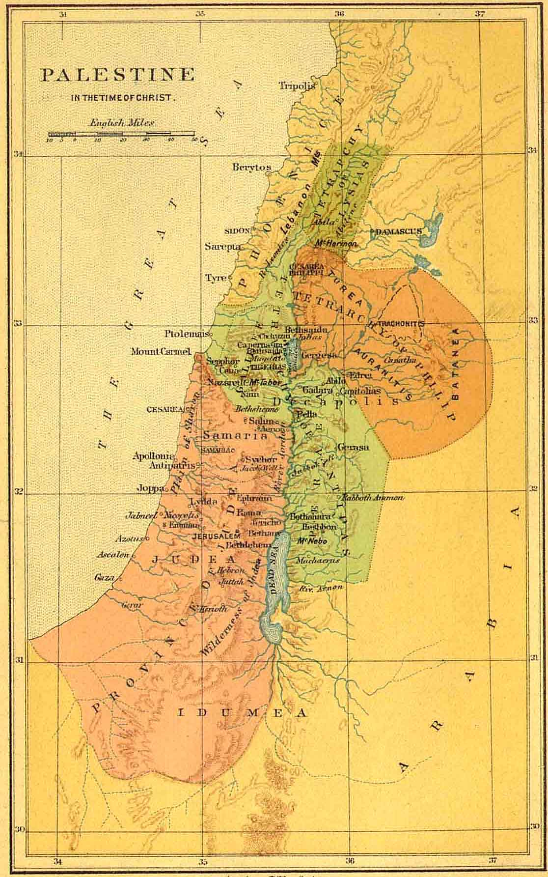
Picture: Palestine in the Time of Christ. KJRSBM 1.7
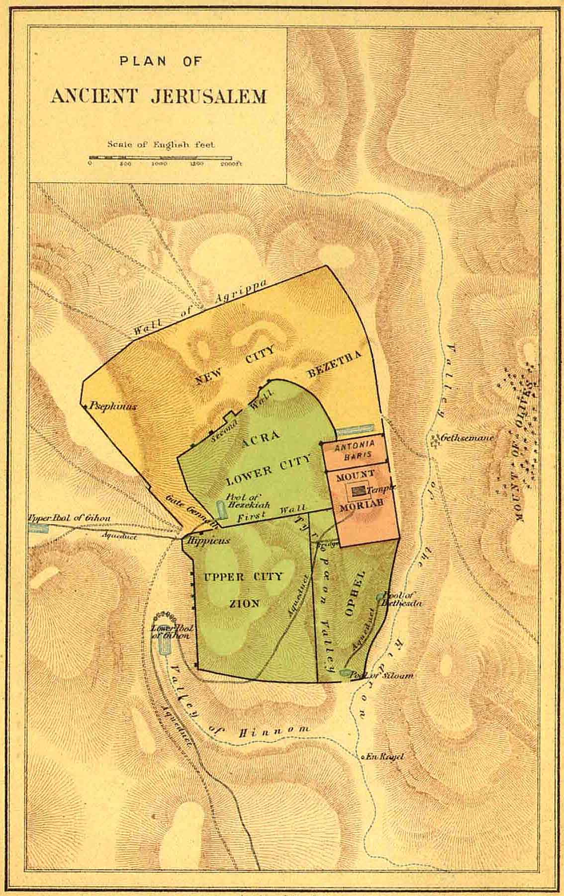
Picture: Plan of Ancient Jerusalem. KJRSBM 1.8
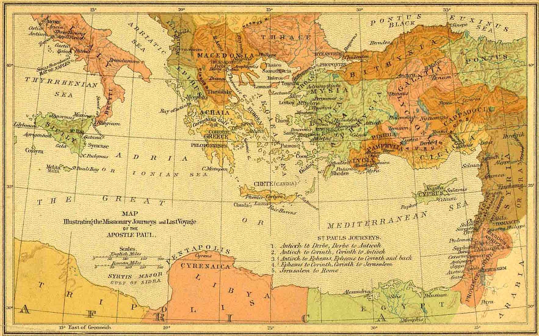
Picture: Map Illustrating the Missionary Journeys and Last Voyage of the Apostle Paul. KJRSBM 1.9